REQUEST A TOUR
In-PersonVirtual Tour

$ 195,000
Est. payment | /mo
14.54 Acres Lot
$ 195,000
Est. payment | /mo
14.54 Acres Lot
Key Details
Property Type Vacant Land
Sub Type Lots/Land
Listing Status Active
Purchase Type For Sale
MLS Listing ID CV24235047
HOA Y/N No
Lot Size 14.540 Acres
Acres 14.54
Property Description
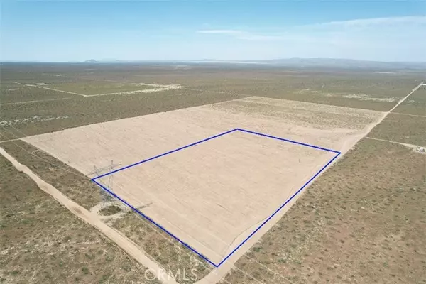
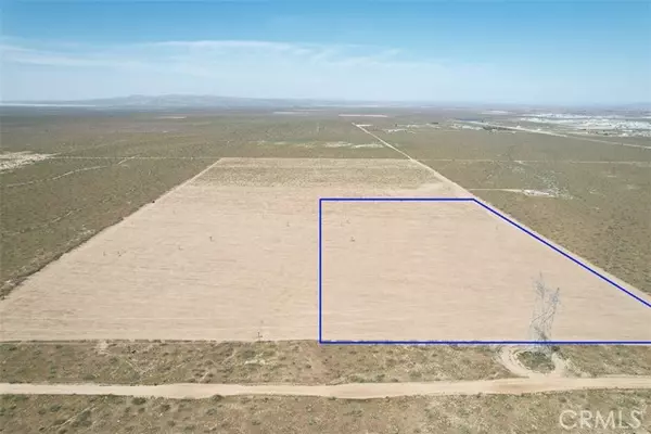
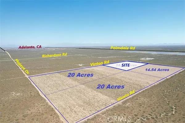
20 acres flat land (APN 3102-171-11-0000) located in the opportunity zone! Ideal for future investment, all Leveled and usable land located on Vinton Rd, cross St Hook Blvd. situated in the Unincorporated area of Adelanto CA, nearby existing solar field, site located 1 mile to paved Palmdale Rd and approximately 2 miles west of Adelanto High School, close to Adelanto Airport, and near the Crossroads at US-395 Hwy. Great long-term hold property at an affordable price, Close to future High Desert Corridor, GPS Coordinates to sign on property are: 34.522500, -117.477694 (3 adjacent parcels also available for sale, 14.54-acre parcel, and 2-20 acre parcels) Bring us your offer.
20 acres flat land (APN 3102-171-11-0000) located in the opportunity zone! Ideal for future investment, all Leveled and usable land located on Vinton Rd, cross St Hook Blvd. situated in the Unincorporated area of Adelanto CA, nearby existing solar field, site located 1 mile to paved Palmdale Rd and approximately 2 miles west of Adelanto High School, close to Adelanto Airport, and near the Crossroads at US-395 Hwy. Great long-term hold property at an affordable price, Close to future High Desert Corridor, GPS Coordinates to sign on property are: 34.522500, -117.477694 (3 adjacent parcels also available for sale, 14.54-acre parcel, and 2-20 acre parcels) Bring us your offer.
20 acres flat land (APN 3102-171-11-0000) located in the opportunity zone! Ideal for future investment, all Leveled and usable land located on Vinton Rd, cross St Hook Blvd. situated in the Unincorporated area of Adelanto CA, nearby existing solar field, site located 1 mile to paved Palmdale Rd and approximately 2 miles west of Adelanto High School, close to Adelanto Airport, and near the Crossroads at US-395 Hwy. Great long-term hold property at an affordable price, Close to future High Desert Corridor, GPS Coordinates to sign on property are: 34.522500, -117.477694 (3 adjacent parcels also available for sale, 14.54-acre parcel, and 2-20 acre parcels) Bring us your offer.
Location
State CA
County San Bernardino
Area Adelanto (92301)
Others
Monthly Total Fees $16
Acceptable Financing Cash
Listing Terms Cash

Listed by MGR REAL ESTATE, INC.
GET MORE INFORMATION

Krystal Lane
Partner | Lic# 1918284


